We provide
"Geo-Spatial, Software Development and Sales & Marketing"
GeoSpatial Technology refers to the field of information technology that focuses on the collection and processing of geographical data and the data tied to geographical references.
We provide Web Design, Web Development, & Search Engine Optimization services. We create custom professional websites and applications, including Content Management Systems (CMS) & E-commerce solutions that are on time & cost effective.
We are committed to providing core and essential geographic information system (GIS) software tools and spatial technologies required to offer location-based services.
Authorized Dealer for ATLAS 3D MOUSE
The Atlas 3D USB MOUSE is specialized for mapping needs with all major stereo software.
We are expertise in Geo-Spatial Data Processing Services,
Photogrammetry, LiDAR, Mobile/UAV Processing, BIM Modeling and CAD & GIS Services.
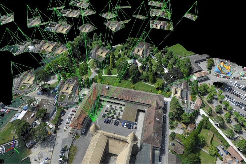
Photogrammetry is defined as the process of deriving metric information about an object through measurements made on the photograph of the object. Photogrammetry is the science of obtaining reliable information through the process of recording, measuring and interpreting photographic images.
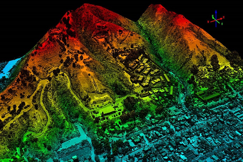
LiDAR (Light Detection and Ranging) is a remote sensing method that uses light in the form of a pulsed laser to measure ranges (variable distances) to the Earth. These light pulses combined with other data recorded by the airborne system generate precise, three-dimensional information about the shape of the Earth and its surface characteristics.
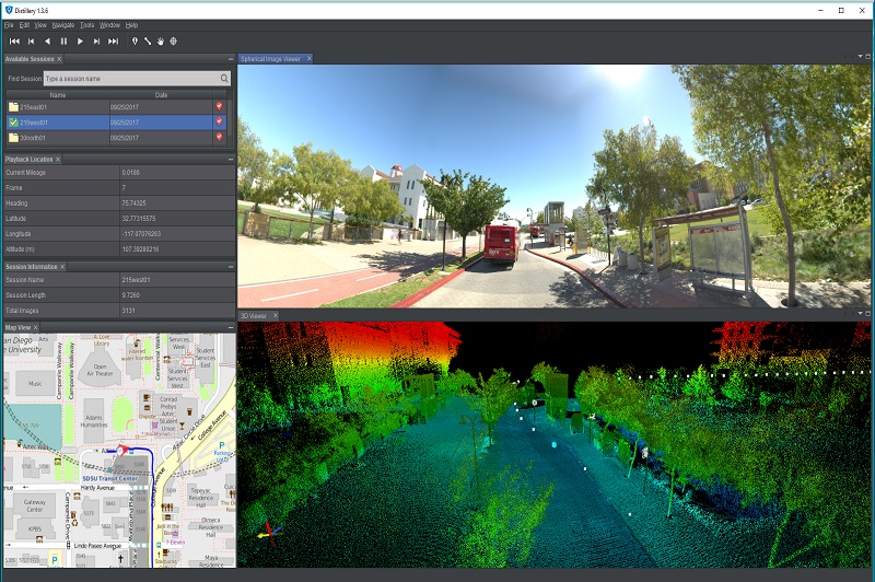
Mobile mapping solutions combine the usability and familiarity of videos and photographic images with the accuracy and precision of LiDAR point clouds to deliver a total asset management solution.
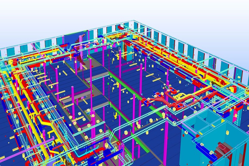
BIM(Building Information Modeling) is an intelligent 3D model-based process that provides architecture, engineering, and construction professionals the insight and tools to more effectively plan, design, construct, and manage buildings and infrastructure.
Converting all raster-based drawings to vector formats, with customized layers, color codes, dimension & text styles. CAD & GIS employees work together as a team to provide valuable mapping, database information & plans for each project. Our GIS data services group can relate information from different sources, build custom applications to enhance performance & deliver a full spectrum of GIS solutions.